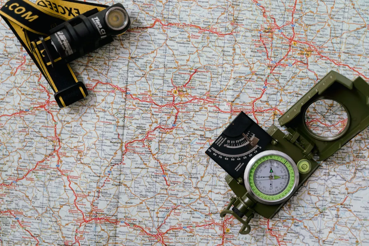
Common Navigation Mistakes New Hillwalkers Make
Navigation goes wrong long before anyone gets lost. It goes wrong in the car park, when the map disappears into a pocket and is not seen again until the cloud comes down. It goes wrong on a bearing walked with confidence and no counting, and in the quiet hope that the right path will eventually appear.
The mistakes new hillwalkers make are few, repetitive and easy to fix. None of them need new kit — just a bit of practice on a familiar hill and a few habits kept going all day.
Ignoring magnetic variation
Your compass needle points at magnetic north; the grid lines on your map run to grid north. The gap between them is magnetic variation, printed on the map margin alongside the date it was calculated and the annual change. In Britain it is small — under a couple of degrees in most places — which is precisely why people skip it. Get it wrong abroad and you can be a whole hillside out.
Do the arithmetic once, at home or at the car park, and write the corrected figure on the map case in pencil. The old rhyme "grid to mag, add" works when variation is westerly, which covers much of Britain, but read the number on your own map rather than trusting the rhyme. Adding two degrees to every bearing is simple; remembering to do it in horizontal rain is not.
Walking a bearing without pacing or timing
A bearing is not an order to walk in a straight line until something turns up. It is a line, and you need to know how far along it you have travelled. Two skills do that job.
- Pacing. Count double paces — every time your left foot lands. Most adults cover roughly 1.5 metres per double pace on level ground, and less in heather or uphill. Measure your own on a track, then expect it to change with the terrain.
- Timing. A rough rule for hill days is four kilometres an hour on level ground, plus about an hour for every 600 metres of ascent, with more allowed for bog, boulders, breaks and tired legs.
Plan each leg before you walk it. Use a handrail — a wall, fence, stream or ridge running the way you want to go — and pick a catching feature beyond the target that you cannot miss, such as a loch shore or a road. Try aiming off, too: if the target is a stream junction, aim a few degrees to one side so you know which way to turn when you reach the water. Walking straight at a small target and hoping is the fastest way to add an hour to a hill day.
Never quite setting the map
Setting the map means turning it until the ground and the paper agree — with the compass, or by lining up two features you can see. It takes seconds and prevents the "I thought we were heading east" conversation.
Fold the map so the relevant section shows and thumb your position, keeping your thumb on the last place you were sure of. Check it against something solid every few minutes: a wall corner, a stream junction, a kink in the path, the shape of the crag above you. One feature is a guess; two or three that fit together is a position. Paths deserve suspicion as well — they fork, fade and sometimes do not exist where the map shows one, so judge the direction and the shape of the ground rather than the line of trodden mud.
Misreading contours and distance
Contours are the shape of the hill drawn in flat lines, and they punish guesswork.
- Interval. Know what one line is worth on your map, often 10 metres. Count them to see how much climbing is left.
- Spacing. Tight lines mean steep ground; wide spacing means gentle slopes.
- Direction. Where contours cross a valley they form a V pointing uphill. On a spur, the pattern points downhill. Walking up a re-entrant convinced it is a ridge catches nearly everyone once.
Distance is the quieter error. Measure along the route you will actually walk, not the straight line across the valley, and keep the scale in mind: 4 cm is a kilometre on a 1:25,000 map, 2 cm on a 1:50,000. Then add time for every switchback, stile and boggy patch.
Letting the phone do the thinking
Phone mapping has made navigation easier and slightly riskier. Cold flattens batteries, water gets into pockets, screens crack, and a route saved at home may refuse to open with no signal. Carry a paper map and compass in a waterproof case, and practise with them so that using them on the hill is not a novelty.
When you do use an app, treat it as a cross-check rather than an oracle. The blue dot tells you where the device thinks you are. It does not tell you that the ground ahead drops into a gully, that the bridge is gone, or that the path runs on the far side of the wall. Look up, match the ground to the map, then look back at the screen.
Bad-weather drift and group silence
Most navigation failures are decision failures in disguise. In cloud and rain everyone goes quiet, the pace drops, and the person holding the map starts to feel that admitting doubt would let the group down. Say it early. "I am not certain where we are" costs nothing in the first hour and a great deal in the third.
Agree a few things before you leave:
- Who is navigating, and who takes over if they need a break.
- A turnaround time based on daylight and the slowest walker, not on hope.
- A route card left with someone at home, with alternatives and an expected return time.
When visibility closes in, stop properly — sheltered, fed, waterproofs on — before you try to fix your position. Navigation done while walking and shivering is guesswork.
A routine that prevents most of it
None of this is complicated, but it only works if it happens in the same order every time. On the hill, run through this cycle whenever something changes — a junction, a summit, a shift in the weather:
- Stop and set the map.
- Fix your position from two or three features.
- Choose the next leg and note the bearing, distance and expected time.
- Identify a handrail and a catching feature.
- Walk it, pacing or timing as you go.
- Arrive, check, repeat.
Ten minutes at the kitchen table with a map of a hill you know well is worth more than any gadget. Learn this on a clear day, so the skills are already there when the cloud arrives. And if you are heading onto higher or winter ground for the first time, a day out with an experienced navigator or a recognised mountain skills course will save you a lot of wet, circular walking.
Photo: Tima Miroshnichenko / Pexels
You Might Also Like
A practical guide to planning a first three-day Lake District hike, covering route choice, realistic daily distances, beds, resupply and what to do when plans change.
Gas, liquid fuel and alcohol stoves each shine in different conditions. We compare weight, fuel availability, cold-weather performance and cost for British camping trips.